August 21, 2020

Tropical Storm Laura

Laura made landfall early Thursday morning and will spread threats of strong winds, flooding rain and tornadoes from the South and mid-Mississippi Valley into the Ohio and Tennessee valleys

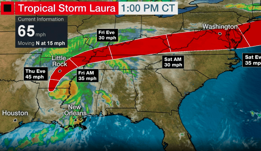
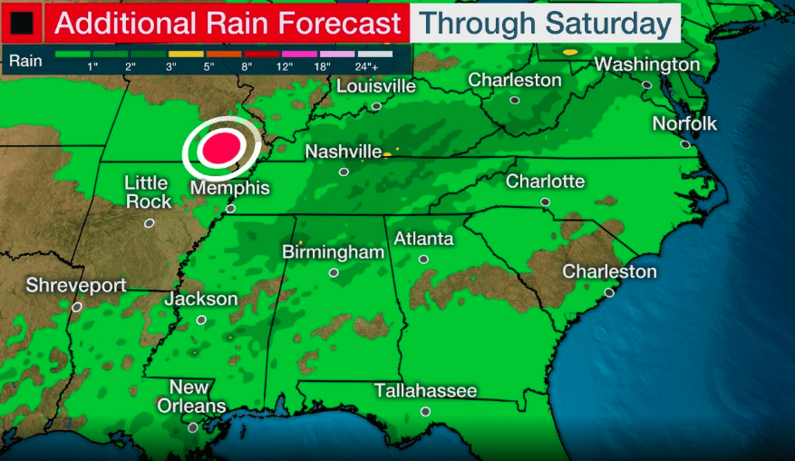
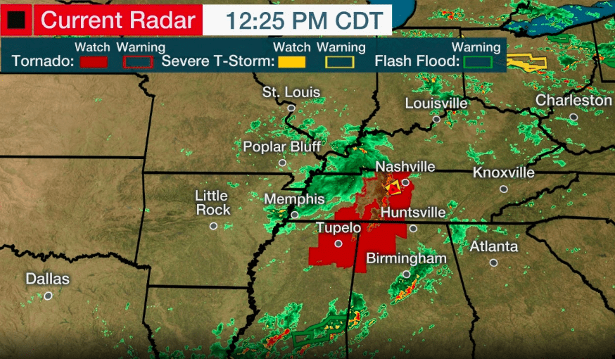
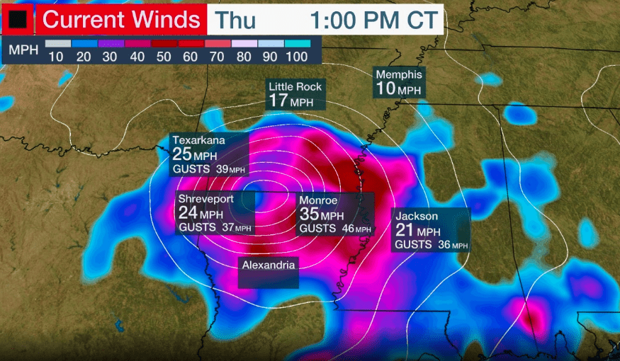
Laura made landfall near Cameron, Louisiana, at 1 a.m. CDT as a strong Category 4 with 150 mph winds, southwest Louisiana’s first Category 4 landfalling hurricane on record, according to NOAA’s historical database. For a complete rundown on the notable storm surge, wind and flooding reports, scroll down to our recap section. Laura is now tracking through the mid-South and mid-Mississippi Valley as a weakening system and is losing tropical characteristics.

Quick Facts

  • Laura made landfall near Cameron, Louisiana, early Thursday with winds of 150 mph
  • Wind gusts of 100 to 135 mph were recorded in southwestern Louisiana
  • Laura is tracking inland from Arkansas to the Lower Ohio Valley with gusty winds
  • Laura is also an inland flood risk as far north and east as the Ohio and Tennessee valleys
  • Isolated tornadoes are also expected from Laura

Watches, Warnings and Evacuations

Resources