Oregon Wildfires - September 2020
Last updated: Monday, September 28th at 9:30am PDT
Oregon Wildires:
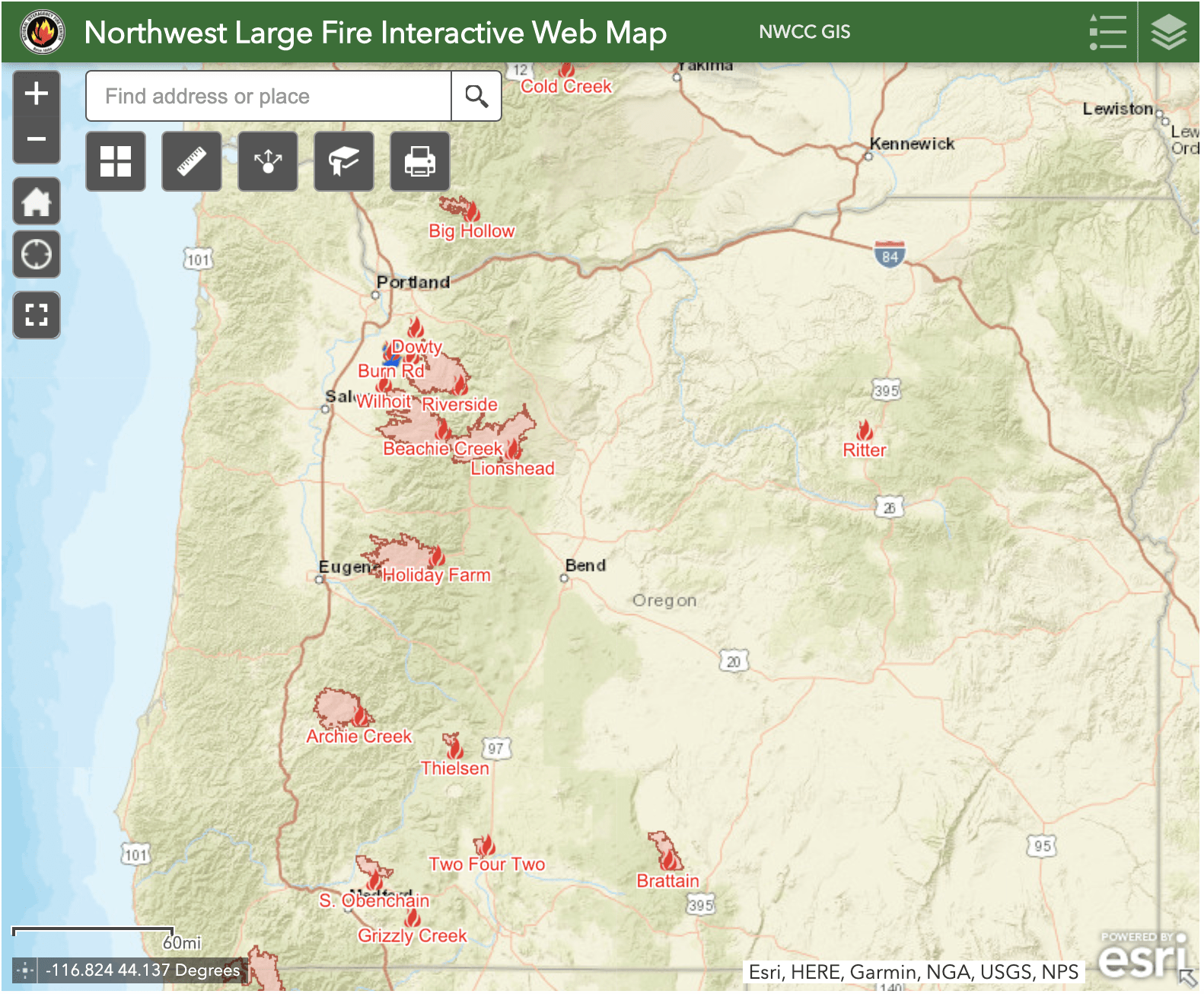
Crews are battling 10 wildfires across Oregon totaling over 975,000 acres. The Beachie Creek Fire, Holiday Farm Fire, Lionshead Fire, Riverside Fire, and Archie Creek Fire are the largest of those fires with each burning over 100,000 acres.
News Coverage & Officials
- Situational Awareness Map (Oregon Office of Emergency Management)
- Thousands evacuate, at least 3 killed as Oregon wildfires burn over 800 square miles (The Oregonian)
- Multiple wildfires burning in Oregon, SW Washington (KGW)
- Full List of Evacuation Orders in Oregon by County (statesman journal)
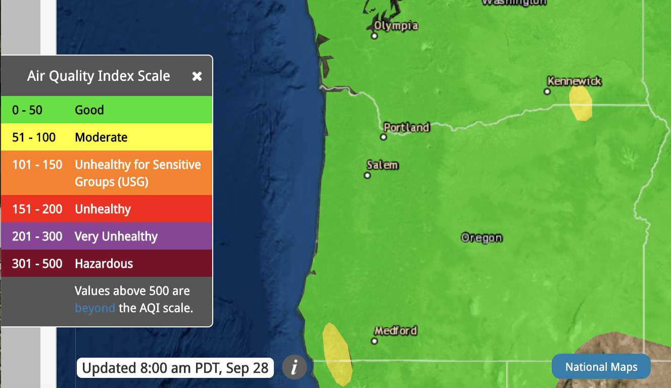
- Air Quality Map (AirNow)
- Fire Alert: Interactive map of major northwest fires (NWCC)
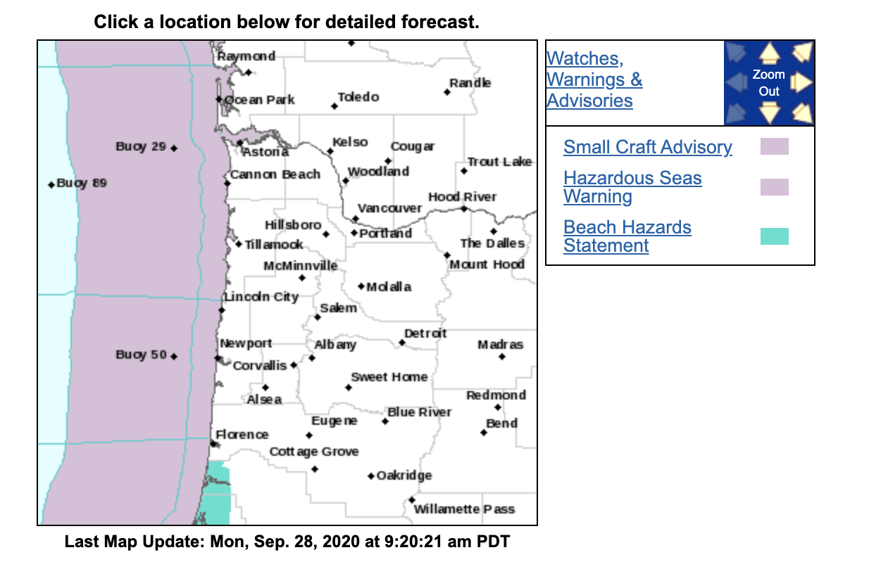
- Oregon Weather Forecast (NWS)
Oregon Wildfires over 100,000 acres

Beachie Creek Fire:
- Size: 192,843 acres
- Containment: 58%
- Total Personnel: 579
- Location: Around 6 miles north of Detroit, OR
- Reported: Sunday, August 16th at 11:18am PDT.
- Cause: Unknown
Holiday Farm Fire:
- Size: 173,094 acres
- Containment: 55%
- Total Personnel: 635
- Location: Along Highway 126 west of McKenzie Bridge to Vida, Oregon
- Reported: Monday, September 7th at 8:20pm PDT
- Cause: Unknown
Lionshead Fire:
- Size: 204,340 acres
- Containment: 34%
- Total Personnel: 1,436
- Location: Lions Head Canyon
- Reported: Sunday, August 16th at 10:45pm PDT
- Cause: Lightning
Riverside Fire:
- Size: 138,029 acres
- Containment: 37%
- Total Personnel: 526
- Location: 2 miles southeast of Estacada, OR
- Reported: Tuesday, September 8th
- Cause: Human
Archie Creek Fire:
- Size: 131,542 acres
- Containment: 69%
- Total Personnel: NA
- Location: East of Roseburg, OR
- Reported: Tuesday, September 8th
- Cause: Unknown
Evacuation Orders (statesman journal):
Marion County
Level 3 – Evacuation order:
- Detroit
- Idahna
- Breitenbush
- Hwy 22 @ N Fork Rd east to Mile Post 29, including N Fork Rd, Pioneer Rd, and other roadways in this corridor
Level 2 – Evacuation Warning
- Lyons
- Mehama
- Mill City
- Gates
- Fernridge Rd west of Shellburg Creek Rd to Basil Hill
- Crooked Finger Rd and Moss Ln
- Wagner Rd
- Wagner Ln
- Teeters Rd
- Gopher Ln
- Jennie Rd south of Hwy 22
Linn County
Level 3 – Evacuation Order
- The area east of the end of Gates Bridge East to the Hwy 22 Junction within Linn County
Level 2 – Evacuation Warning
- The City of Lyons, including 16th St behind Freres, and Clipfell Ln, and all areas between the railroad tracks that intersect with Hwy 226 and north to the Linn/Marion County line, east to Cedar Mill Rd, south to Thomas Creek Dr
- The Cities of Mill City and Gates including Cedar Mill Rd on Lyons-Mill City Dr, to the end of Gates Bridge East, and all side roads
Clackamas County
Level 3 – Evacuation Order
- Dodge
- Bedford Point
- La Dee Flat
Level 2 – Evacuation Warning
- Parts of Elwood
- Parts of Faraday
Lincoln County
Level 3 – Evacuation Order
- All of N Panther Creek Rd, N Deer Valley Rd, and N Yodel Rd, and all side roads
- N Corkhill Rd, N Durette Rd, and addresses on N North Bank Rd between N Deer Valley and N Panther Creek
Level 2 – Evacuation Warning
- N North Bank Rd from Hwy 18 to North Panther Creek
- The West portion of N North Bank Rd from N Old Scenic Hwy 101 to 0.5 mile marker
- Hwy 18 residential addresses between N Old Scenic Hwy 101 and milepost 5
Lane County
Level 2 – Evacuation Warning
- Hwy 126 between Camp Creek Rd and McKenzie Ranger Station, including connecting roads
- Deerhorn Rd and connecting roads from the west entrance at Hwy 126 to the last residential property
Jackson County
Level 3 – Evacuation Order
- Areas inside the immediate burn area.
Level 2 – Evacuation Warning
- Portions of Talent west of Talent Ave
- San George Estates
- All properties accessing Brophy, Ball, Reese Creek, and Worthington Roads
- All properties on Crowfoot Rd, 1 mile north of Butte Falls Hwy to OR-62
- Areas south of OR-140 and north of Brownsboro
- Butte Falls Hwy from OR-62 to Reese Creek Rd and all of Hwy 62
- Nearly all of the City of Shady Cove and Trail
Douglas County
Level 3 – Evacuation Order
- Dry Creek (Happy Creek Ln, Felix Flat, Elk Ridge, Illahee)
- Steamboat Creek to the Green Bridge in Glide
- Bar L Ranch Rd
- Diamond Lake
Level 2 – Evacuation Warning
- Parts of Steamboat
- Parts of Idleyld Park
- Upper Terrace Dr
- Terrace


