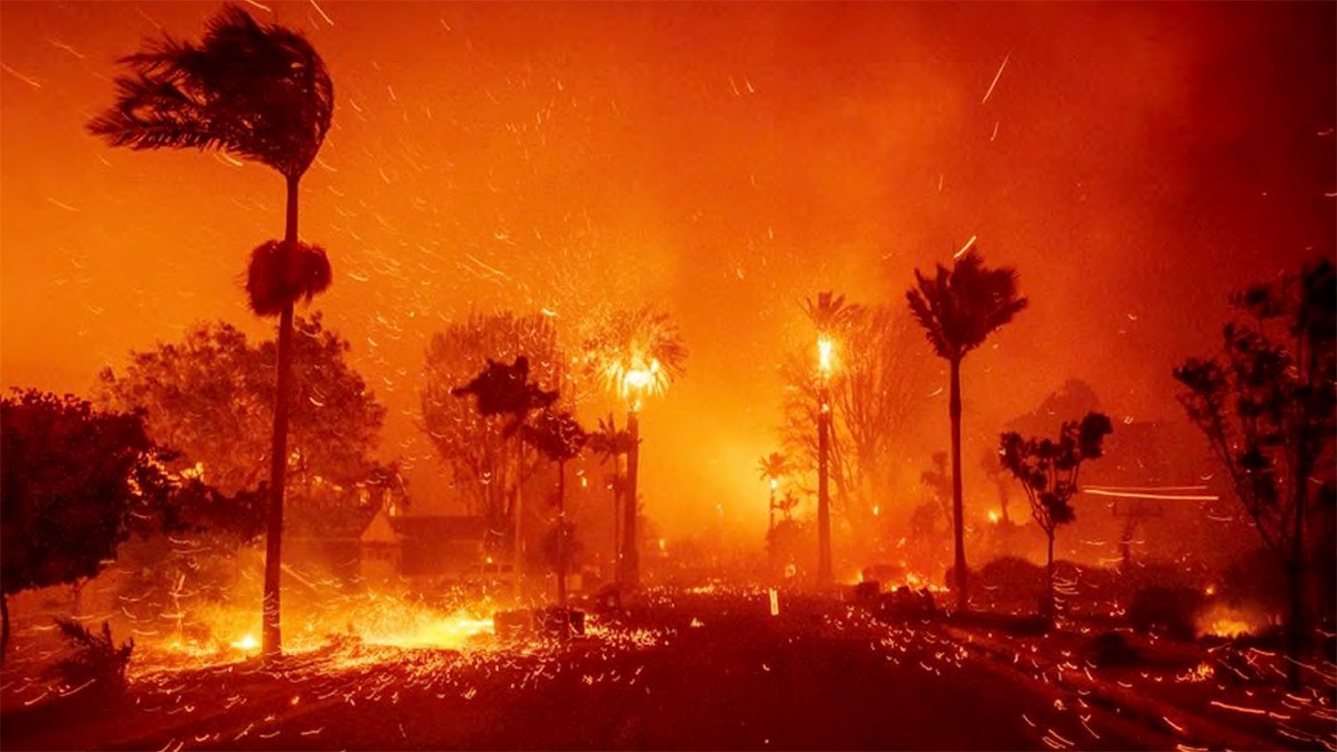


The Eaton Fire began on the evening of January 7, 2025 in Eaton Canyon and was driven downslope by hurricane‑force winds into foothill communities including Altadena and northern Pasadena. It ultimately burned 14,021 acres and destroyed more than 9,400 structures, resulting in at least 18 fatalities.
Simultaneously, the Palisades Fire ignited earlier the same day in the Santa Monica Mountains. Fed by the same extreme windstorm and drought‑stressed vegetation, the fire swept through Pacific Palisades, Topanga, and Malibu, burning 23,448 acres, destroying 6,837 structures, and causing 12 deaths.
Combined, the two fires drove the majority of regional losses during the broader January 2025 Southern California wildfires, which destroyed over 18,000 homes and structures and forced evacuation orders for more than 200,000 people.
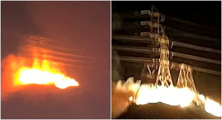
Cell phone images of the first moments after the Eaton Fire ignited on Tuesday Jan 7 2025 on the mountainside opposite Midwick Drives terminus at N Altadena Drive in Altadena [Jennifer Errico]
Leading up to the fires, Los Angeles experienced:
- Eight months with no measurable rainfall, leaving heavy fuel loads after vegetation growth from prior wet seasons.
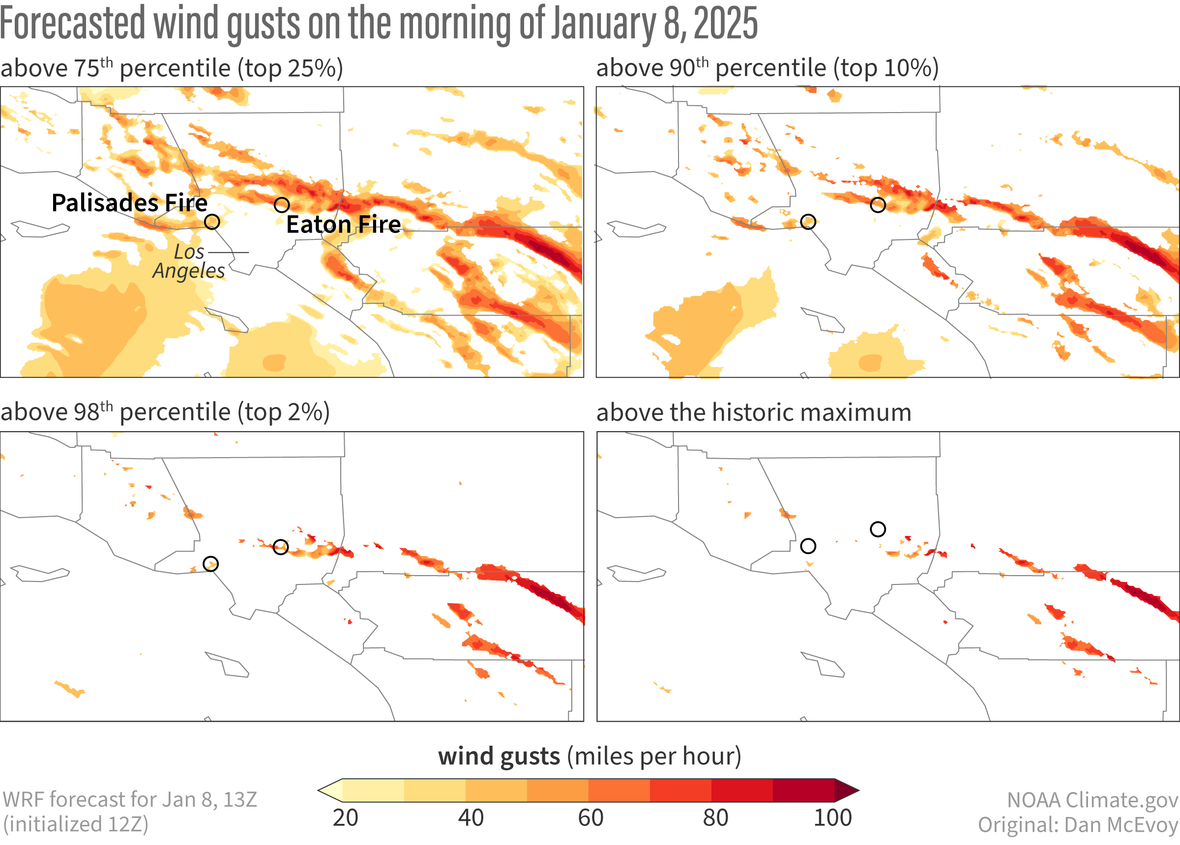
- A strong Great Basin high‑pressure system producing life‑threatening Santa Ana winds, with gusts forecasted and observed in the 60–80 mph range.
- PDS Red Flag Warnings, issued by the National Weather Service, signaling extreme fire danger across multiple counties.
These conditions created what CAL FIRE officials described as “the perfect recipe for a large wildfire.”
While the extreme wind conditions of January 7–8 drove rapid fire spread, the Eaton and Palisades Fires also exposed significant challenges in emergency alerting, evacuation notification, and interagency information flow. For security and business‑continuity teams evaluating regional readiness, several issues have emerged as points of concern.
Delayed or Missed Evacuation Alerts in Hard‑Hit Areas
Multiple residents in west Altadena, the area where the majority of Eaton Fire fatalities occurred, reported receiving no emergency notifications before their homes were already burning. Several described losing cell service and power before any official alert reached them, forcing self‑evacuations without actionable information. According to resident accounts, evacuation text messages did not arrive until after 3:00 a.m., hours after flames had entered neighborhoods.
Meanwhile, scanner traffic, CAL FIRE data, and field reports reviewed by the Associated Press show that house fires were being reported in west‑side Altadena more than an hour before the first evacuation orders were issued for those blocks, indicating a communications bottleneck between field observations and public alerting.
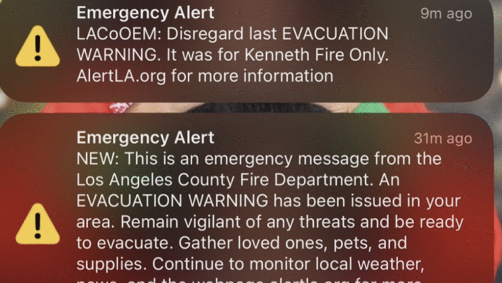
A photo of a false emergency alert issued during the Los Angeles Wildfires. / Breanna Reeves
Fragmented and Overlapping Alert Systems
Los Angeles County’s emergency communications landscape includes numerous overlapping opt‑in systems, AlertLACounty, city‑level systems, Sheriff’s Department alerts, and 57 additional localized signup links for neighborhoods, with no clear indication of how these platforms coordinate during a fast‑moving crisis. Residents described confusion about which system to trust, and whether alerts sent to one platform propagated consistently across others.
A 2024 Hazard Mitigation Plan had already identified gaps in alerting in areas with poor cell coverage and assigned the issue a “medium” priority with a 10‑year completion timeline, leaving vulnerabilities unresolved when the fires hit. The County’s broader plan did not specifically highlight alerting at all, focusing instead on wildfire education and vegetation risks.